
 A US Navy meteorological map shows Cyclone Giri as it hits the Arakan coast on Friday morning. (PHOTO: US Navy)
 A tropical cyclone has hit Burma's Arakan State and has been upgraded to a “Category II” cyclone, Myanmar Climate Change Watch has said.
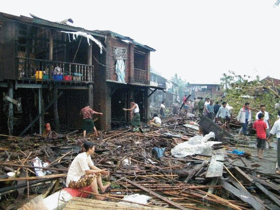
Cyclone Giri, which formed over the Bay of Bengal in the Indian Ocean, has reached a “very destructive stage” with winds of up to 120 km per hour, and is due to hit Kyaukphyu, a major town in Arakan State, by 3 p.m. local time.
The water level in the region is expected to increase some five to six feet, according to the latest forecast from the local weather board.
According to the US Joint Typhoon Warning Center, the cyclone was located about 220 km southwest of Sittwe in Arakan State at 12:30 a.m. local time and was moving north-northeast at 7.4 kph.
The center's latest warning states that the cyclone is headed in the direction of Mandalay Division and may make landfall with winds of 148 kph.
“The cyclone will become stronger around 2 p.m., but will not be as strong as 2008's Cyclone Nargis,” said Tun Lwin, the former director-general of Burma's Meteorology and Hydrology Department, who heads Myanmar Climate Change Watch.
He warned that locals should not go outdoors as heavy winds could lead to the collapse of trees and lampposts, and that the residents living near the sea should avoid going to the coastline.


0 Responses to Cyclone Giri Hits Arakan State