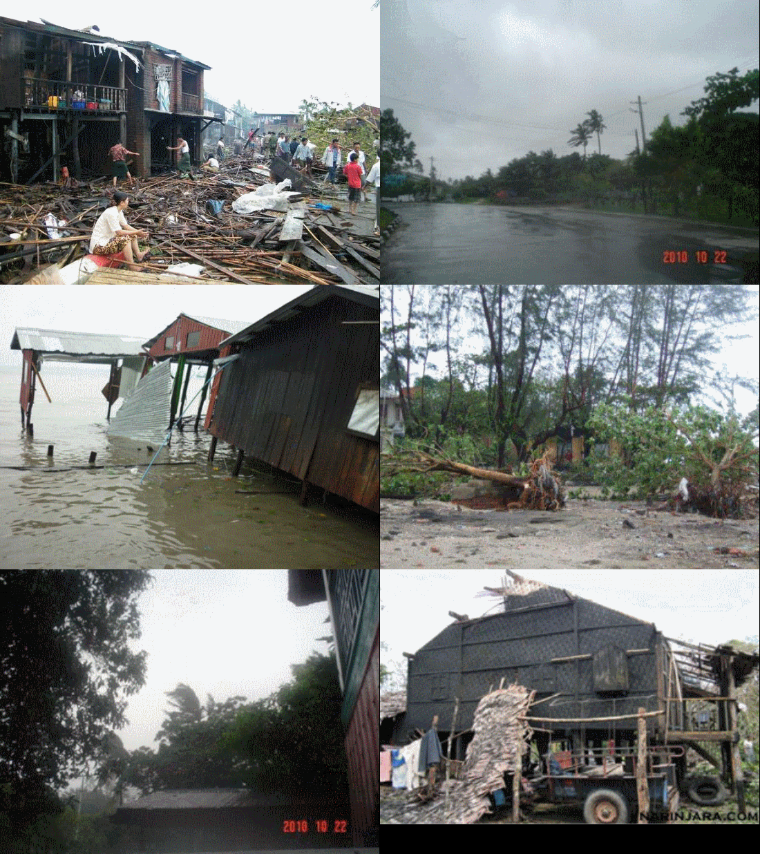
Rangoon (Mizzima) – Winds and driving rain from a strengthening Cyclone Giri are lashing Burma’s western coast as it was expected to make landfall between Sittwe and Kyaukphyu townships this afternoon, Arakan State, according to residents and a US weather warning centre today.

The most recent satellite/graphic image this afternoon of Cyclone Giri’s position from British analysts Tropical Storm Risk at University College London shows Giri approaching the western coast of Burma to the north of Kyaukphyu. The image puts already flood-hit Mandalay Division in its path. Photo: Tropical Storm Risk
In Mizzima’s most recent update from the port of Sittwe, a fisheries businessman said at 4.30 p.m.: “The weather is dreadful. I’ve heard a storm will hit our area. At the moment moderate rain is falling but it will be heavy soon. The tide will occur in the evening and a strong gale is blowing.
“Township Peace and Development Council arranged motorboats for villagers to move out of the high-risk areas [up the local river]. All women from rural areas have moved to high ground,” he said.
However, NetIndian news reported an hour ago that the India Meteorological Department (IMD) said at 11:30 a.m. in a bulletin the cyclone remained practically stationary and lay centred at about 90 miles (about 145 kilometres) south of Sittwe and 110 kilometres west-southwest of Kyaukpyu, and 240 south-southeast of Teknaf in Bangladesh near the Burmese border.
A Category 1 Storm is the lowest on the five-step Saffir Simpson scale and capable of “very dangerous winds”, according to the US National Hurricane Centre.
A resident from Kyaukphyu told Mizzima: “I think the storm will come soon. Now, the gale is stronger than it was at noon. There is also [heavy] rainfall.”
The cyclone was located about 136 miles (220 kilometres) south- southwest of Sittwe at 12:30 a.m. local time and was moving north-northeast at 4.6 km/h. Giri is expected to increase in strength and hit the coast near Sittwe later today, according to the centre. It may make landfall with winds of 148 km/h.
A motorboat owner in Kyaukphyu told Mizzima about conditions on the ground at 1:00 pm: “A strong gale is blowing across Kyaukphyu. It is over the speed of 35 miles per hour. No damage! The authorities warned the people about the potential cyclone through loudspeakers. The residents from the villages near the sea were urged to move to the schools. People are preparing for the potential cyclone. People from rural areas are also moving to safer places”
In the Indian Ocean, the US Navy uses the term tropical cyclones to describe all large circular weather systems built around an area of low pressure. It is the fourth storm of the season in the Bay of Bengal.
British weather analysts from Tropical Storm Risk at University College London however said the storm was more likely to hit Burma closer to Kyaukphyu.
Kyaukphyu Township Peace and Development Council warned the cyclone across the town through loudspeakers.
Similarly, gales were blowing and rainfall logged south along the coast from Kyaukphyu in Maei and Lamu villages in Toungup and in Manaung townships, residents said.
“I have prepared bags that are easy to carry. The state radio said the cyclone was approaching Kyaukphyu, which is why I prepared,” a resident from Panhtawkyun village in Toungup said.
Dr. Tun Lwin, the former director-general of Burma’s Burma’s Meteorology and Hydrology Department, also warned of a storm surge from Giri.
“The [storm] tide will occur and it’ll be about five to six feet above sea level,” he said.
The fisheries businessman in Sittwe explained what the storm surge would mean for residents.
“Although there is no serious problem for people in the centre of town, residents in rural areas and villages will encounter many problems. When the tide rises, salty water will inundate farmland. Then, shrimp farms will be spoiled. In the past, the shrimp hatcheries and farms had been spoiled because of the salty seawater,” the businessman said.
State-run media triggered a “red alert” for the cyclone and said that a storm was blowing in Kyaukphyu and Sittwe with wind speeds of more than 20 miles per hour.
A retailer in the port of Sittwe, northwest along the coast from Kyaukphyu at 12:30 p.m. told Mizzima: “There is moderate rainfall here. A gale is also blowing. The local fire department warned the people about the potential cyclone. People are also preparing.”
An hour later, a housewife also in Sittwe, said: “People from Strand Ward, Sittwe, are moving to safe places with their own plans. The local authorities have warned boats to stay in port. Now, the wind is calm, but people said that it was the sign of serious conditions [on the way]. The local fire department also warned the public about the storm.”
Cyclone Nargis, which bore winds of more than 120 miles per hour, hit the Irrawaddy Delta and Rangoon in early May 2008 leaving 140,000 people dead and at least 2.5 million displaced.
A UN panel on North Indian Tropical Cyclones in 2000 agreed to assign names to the tropical cyclones in the North Indian Ocean. After long deliberations among the member countries, the naming of depressions developing into a Cyclonic Storm in the North Indian Ocean began from September 2004, with the first name assigned to Cyclone Onil, which developed over the Arabian Sea in late September 2004. As with Cyclone Giri, that name was assigned by the IMD (India) Meteorological Department (IMD).
Each country gave eight names for the cyclones and a list of 64 names was prepared. It was also decided that the eight countries would take turns to name the cyclones. The IMD said at the time: “The practice of naming storms was adopted because it was proved that short names are easier to remember than numbers and other technical terms.”
Giri comes from the Sanskrit and means mountain. As a Sanskrit honorific it means “venerable, elevated, worshipful”.
http://www.mizzima.com/news/breaking-and-news-brief/4482-western-burma-battens-down-as-cyclone-giri-lashes-coast.html


0 Responses to Western Burma battens down as Cyclone Giri lashes coast